- Resources
- How Houston’s model could change the way cities map air pollution
Resources
How Houston’s model could change the way cities map air pollution
Published: January 29, 2020 by EDF Staff
Ordinary fleet vehicles doing their normal jobs in cities have hidden potential to shape actions that protect health and the climate. This is possible with the help of advanced mobile air pollution sensors paired with connected vehicle GPS technologies that allow cities to map pollutants at a hyperlocal scale.
Air quality can be eight times worse at one end of a block than another. These types of differences in air quality exposure can lead to significant health disparities between neighbors. The way we currently track and measure air pollution, with stationary sensors spaced miles apart, can be dramatically enhanced with mobile monitoring. In turn, this could lead to a step change in the way we manage air pollution at both regional and neighborhood scales.
A feasibility analysis from EDF and connected transportation expert Geotab shows that public and private fleets can provide urgently needed data. In fact, it doesn’t take many vehicles to do so. We found that 10-20 vehicles can map 50% to 70% of a city in six months without changing their routes. The opportunity here is huge. Cities are the future of our economy and of environmental innovation, and with hyperlocal mapping, leaders can design – and see the results of – climate and clean air investments that maximize local impact.
To test this idea, EDF piloted fleet-based air pollution mapping in the city of Houston, TX, where sensors were connected to two municipal fleet vehicles.
Results
Even in a relatively short period of time, the vehicles were able to cover wide area, collecting air quality data in locations beyond what is currently possible with existing stationary sensors for particulate matter in the city.
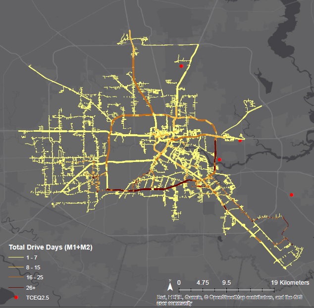
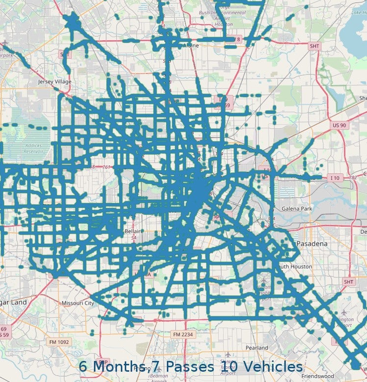
Increasing the number of vehicles by only a small number can significantly increase overall coverage, drive passes, and data that sensors can collect. The map below shows the coverage that is possible with 10 fleet vehicles over a six month period.
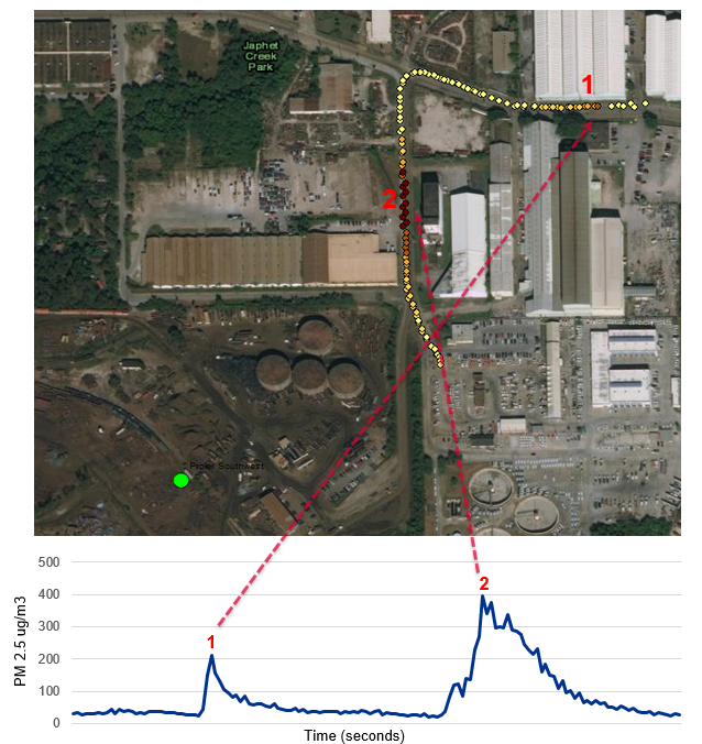
As the vehicles drove their regular routes, the attached sensors gathered data on repeated passes to identify potential ‘hotspots’ or problem areas that would benefit from further investigation. Consistent observations on different days and across multiple drive passes are important in generating useful information about hyperlocal air pollution, such as identifying noticeable peaks and determining whether they persist over time.
One example where the vehicles detected high levels of air pollution on multiple occasions is:
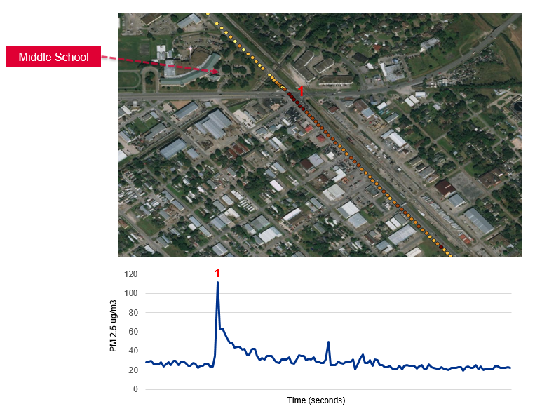
One peak in PM2.5 was observed on Galveston Road at a busy intersection on two different days. This intersection is next to a middle school, park, and residential neighborhood.
Opportunity for other cities
Houston and others are developing platforms for fleet vehicles to map air pollution and apply that data in city decision-making. Whether you’re a public or private sector leader, a tech company or an analytics firm, new sensors and analytics can improve individual lives and entire communities. Become a champion for healthy, smart cities – learn how you can pilot fleet-based air pollution mapping in your city or accelerate IoT solutions.
